OpenStreetMap is a free (as in free software) alternative to Google Maps. I’d say the 2 most important differences with Google Maps are 1) the license and 2) the possibility to contribute. OpenStreetMap relies on its users to add a lot of extra data, such as shops, accommodations, transportation, banks, etc. Additionally, I don’t know if it’s the same in every other countries, but for France the building data are particularly accurate because OSM was allowed to import official cadastral data. So you get to see a very detailed view of buildings. This seems to be the case also for Vienna and London. For New York building data seem a lot sparser.
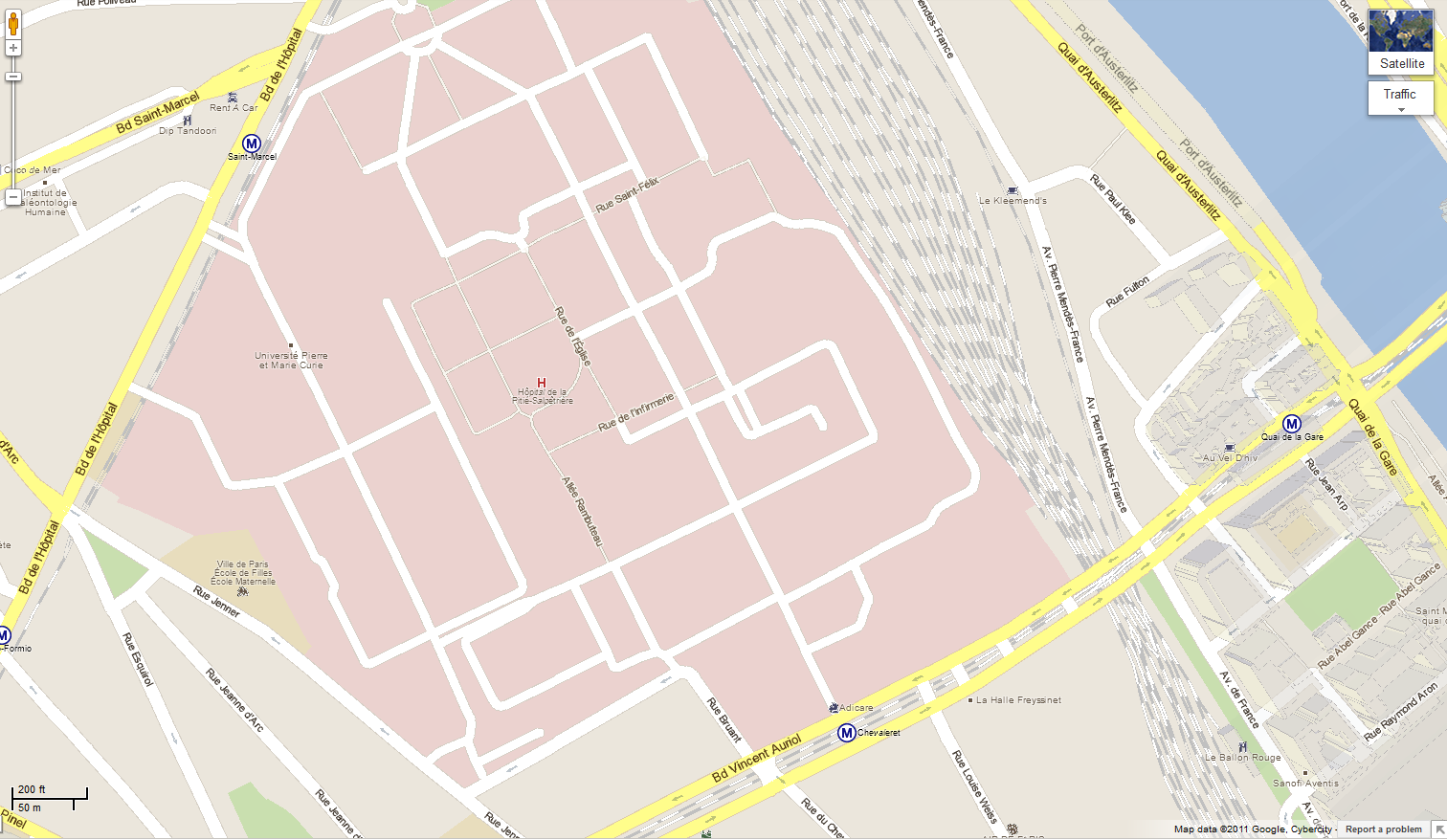
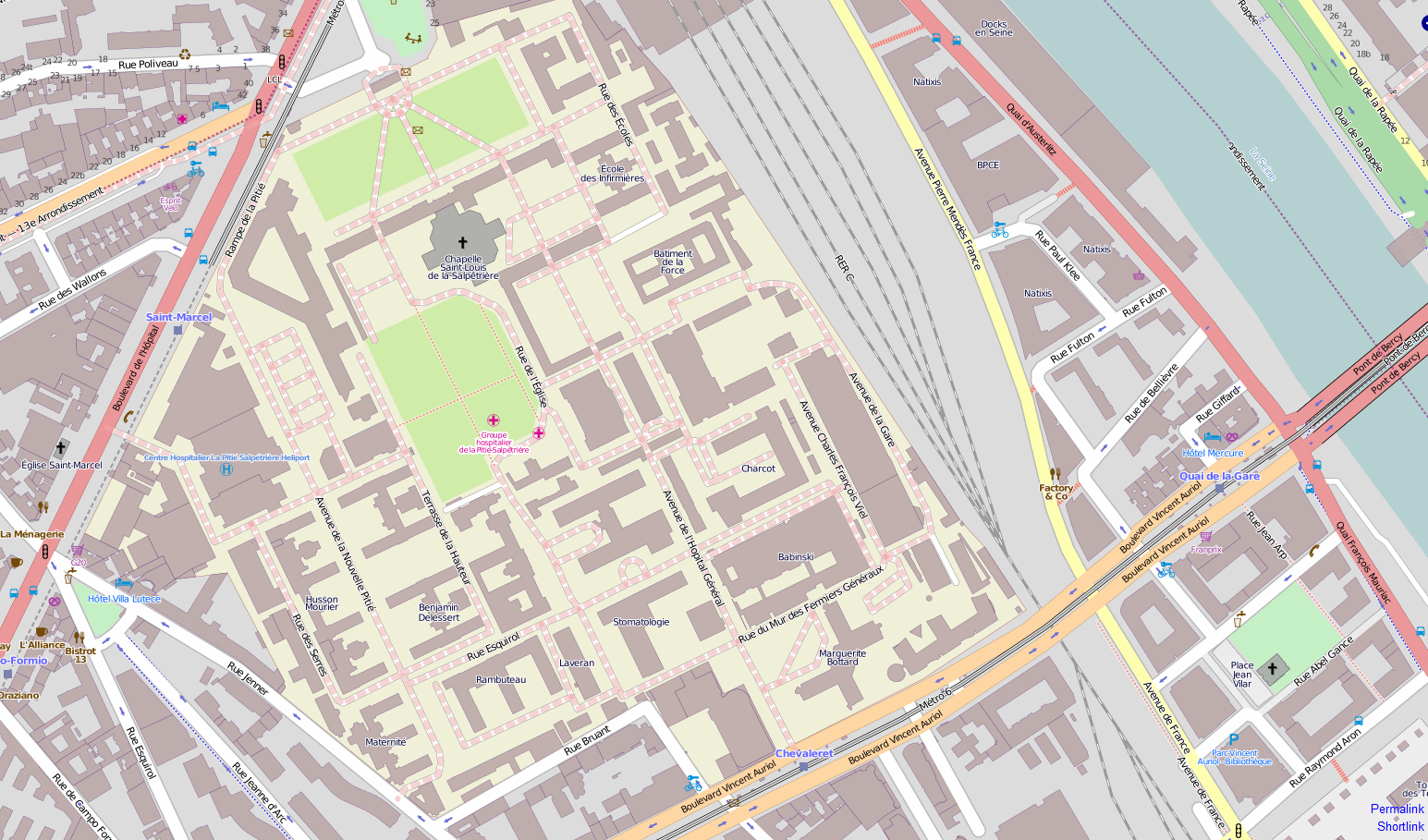
Rather than a long discussion, let’s give you an illustrative picture: here are 2 maps of Centre Hospitalo-Universitaire (CHU) Pitié-Salpêtrière, one of Europe’s largest teaching hospitals. First, the Google Map version. Then the OpenStreetMap version. Notice how the first one shows no building and very few street names (not the most noticeable ones, too!), while the second not only shows buildings but also provides the names of some of them, and also show village greens.


I know and i love open street map 🙂 Nice to find other people using and posting about osm 🙂
Maybe you’ll want to use it on your site instead of Google Maps, then… 😛